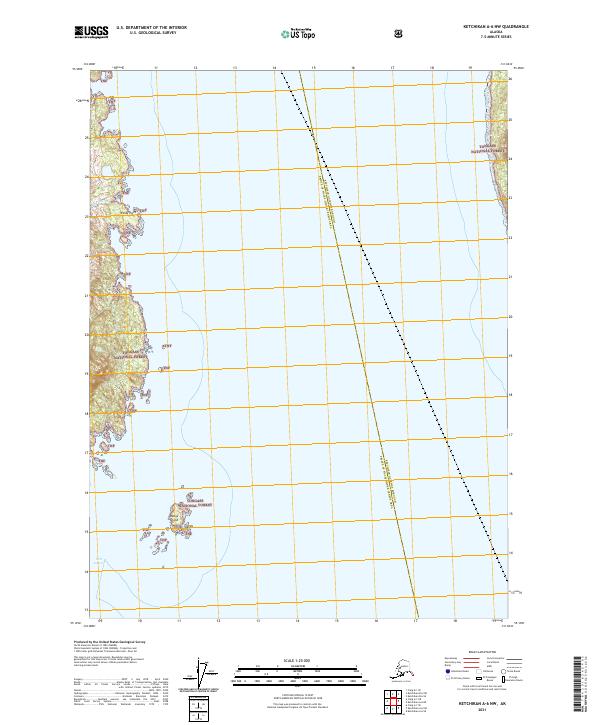
2021 Map of Ketchikan A-6 NW
USGS Topo · Published 2021About this map
Tongass National Forest dominates this coastal landscape, covering the islands and mainland shores of Southeast Alaska. This 2021 survey illustrates the complex maritime geography of the Alexander Archipelago, where deep waterways like Port Johnson and Halibut Cr cut into the timbered coastline. The map highlights the maritime hazards and navigational landmarks of the region, including the prominent Windy Point and the isolated Wedge Island situated within the larger cluster of the Wedge Islands. A notable administrative boundary bisects the open water, marking the division between the Ketchikan Gateway Borough and Prince of Wales-Hyder Census Area. This digital-age topographic study reflects the modern management of these protected forest lands, showing the lack of developed infrastructure in this wilderness environment.
Find a feature on this map
13 named features on this map. Tap any name to fly to it.
Don’t see what you’re looking for? This feature index may not catch every label — zoom into the map to look around manually.
Map Details
Editions of this 2021 Ketchikan A-6 NW Map
This is the sole edition of this map. No revisions or reprints were ever made.
Other maps of this area

1948 · Ketchikan A-6
USGS Topo · 1:63,360

1948 · Craig A-1
USGS Topo · 1:63,360

1949 · Craig B-1
USGS Topo · 1:63,360

1950 · Craig B-1
USGS Topo · 1:63,360

1952 · Ketchikan
USGS Topo · 1:250,000

1953 · Ketchikan B-6
USGS Topo · 1:63,360

1954 · Ketchikan B-6
USGS Topo · 1:63,360

1955 · Ketchikan
USGS Topo · 1:250,000

1957 · Craig
USGS Topo · 1:250,000
1991 · Ketchikan B-6 SE
USGS Topo · 1:25,000