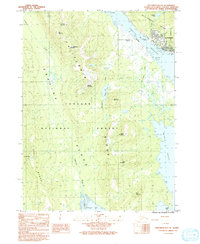
1991 Map of Ketchikan B-6 SE
USGS Topo · Published 1991About this map
Revillagigedo Island and Gravina Island dominate this coastal survey, separated by the vital waterway of the Tongass Narrows. In the early 1990s, the city of Ketchikan appears as a dense grid of streets along the eastern shore, supported by maritime infrastructure including a Heliport and a Seaplane Base. Across the narrows on Gravina Island, the Ketchikan International Airport occupies the shoreline at Charcoal Point, illustrating the unique geographic separation between the town and its primary airfield.
Find a feature on this map
33 named features on this map. Tap any name to fly to it.
Don’t see what you’re looking for? This feature index may not catch every label — zoom into the map to look around manually.
Map Details
Editions of this 1991 Ketchikan B-6 SE Map
This is the sole edition of this map. No revisions or reprints were ever made.
Other maps of this area

1948 · Ketchikan A-6
USGS Topo · 1:63,360

1952 · Ketchikan
USGS Topo · 1:250,000

1953 · Ketchikan B-6
USGS Topo · 1:63,360

1954 · Ketchikan B-5
USGS Topo · 1:63,360

1954 · Ketchikan B-6
USGS Topo · 1:63,360

1955 · Ketchikan A-5
USGS Topo · 1:63,360

1955 · Ketchikan
USGS Topo · 1:250,000

1955 · Ketchikan B-5
USGS Topo · 1:63,360
1991 · Ketchikan B-5 SW
USGS Topo · 1:25,000
1991 · Ketchikan B-5 NW
USGS Topo · 1:25,000