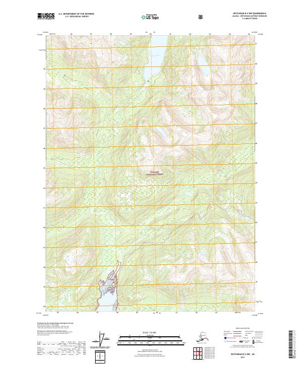
2021 Map of Ketchikan B-2 NW
USGS Topo · Published 2021About this map
Tongass National Forest dominates this Alaskan landscape, where the high-elevation terrain of the Ketchikan Gateway Borough is defined by its deep glacial valleys and significant water systems. The map centers on the massive Wilson Lake, which feeds into the Wilson River as it carves southward toward the coast. To the east, the Blossom River follows a parallel course, highlighting the drainage patterns characteristic of the coastal mountains. Human presence is sparse in this protected wilderness, marked primarily by the Quartz Hill Access route which snakes through the southern portion of the sheet. This access corridor provides a rare entry point into the interior of the Tnf (Tongass National Forest), hinting at the area's resource management and exploration history within the larger Prince of Wales-Hyder region.
Find a feature on this map
12 named features on this map. Tap any name to fly to it.
Don’t see what you’re looking for? This feature index may not catch every label — zoom into the map to look around manually.
Map Details
Editions of this 2021 Ketchikan B-2 NW Map
This is the sole edition of this map. No revisions or reprints were ever made.
Other maps of this area

1952 · Ketchikan
USGS Topo · 1:250,000

1955 · Ketchikan C-3
USGS Topo · 1:63,360

1955 · Ketchikan C-2
USGS Topo · 1:63,360

1955 · Ketchikan B-2
USGS Topo · 1:63,360

1955 · Ketchikan B-3
USGS Topo · 1:63,360

1955 · Ketchikan
USGS Topo · 1:250,000

1996 · Ketchikan C-2
USGS Topo · 1:63,360
1996 · Ketchikan C-3
USGS Topo · 1:63,360
2018 · Ketchikan B-3 NE
USGS Topo · 1:25,000
2018 · Ketchikan B-2 NE
USGS Topo · 1:25,000