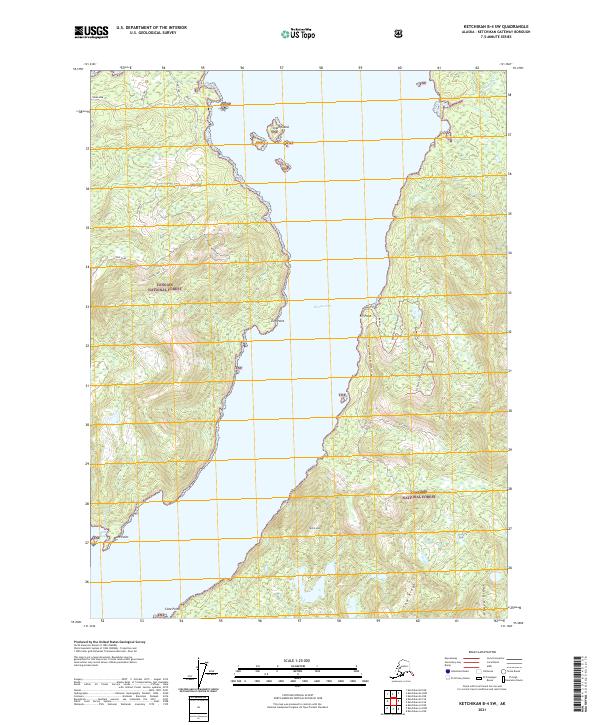
2021 Map of Ketchikan B-4 SW
USGS Topo · Published 2021About this map
Thorne Arm dominates the landscape of this 2021 survey, a deep waterway flanked by the dense timberlands of the Tongass National Forest. The map details a labyrinthine coastline of inlets and points, including Coho Cove and Gnat Cove to the west, and the protected waters of Moth Bay further south. While largely a wilderness area, the terrain is marked by significant peaks and ridges like Notch Mtn and Alava Ridge, reflecting the steep ascent from the shoreline to the inland mountains.
Find a feature on this map
29 named features on this map. Tap any name to fly to it.
Don’t see what you’re looking for? This feature index may not catch every label — zoom into the map to look around manually.
Map Details
Editions of this 2021 Ketchikan B-4 SW Map
This is the sole edition of this map. No revisions or reprints were ever made.
Other maps of this area

1949 · Ketchikan B-4
USGS Topo · 1:63,360

1952 · Ketchikan
USGS Topo · 1:250,000

1952 · Ketchikan B-4
USGS Topo · 1:63,360

1954 · Ketchikan B-5
USGS Topo · 1:63,360

1955 · Ketchikan A-4
USGS Topo · 1:63,360

1955 · Ketchikan A-5
USGS Topo · 1:63,360

1955 · Ketchikan
USGS Topo · 1:250,000

1955 · Ketchikan B-5
USGS Topo · 1:63,360
1994 · Ketchikan B-5
USGS Topo · 1:63,360
1995 · Ketchikan B-4
USGS Topo · 1:63,360