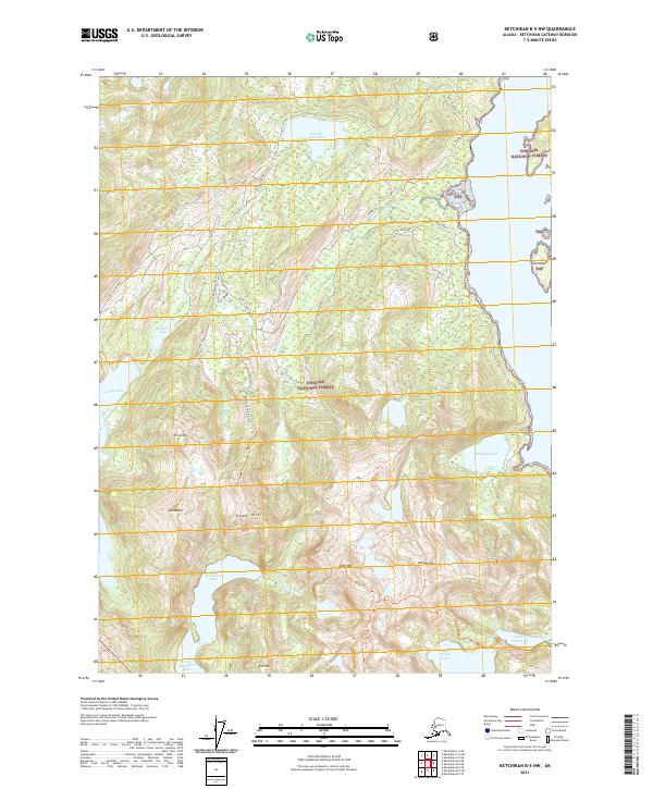
2021 Map of Ketchikan B-5 NW
USGS Topo · Published 2021About this map
Tongass National Forest surrounds this montane landscape on Revillagigedo Island, where a complex network of high-elevation lakes and interior peaks dominates the terrain. The geography is defined by significant freshwater bodies like Harriet Hunt Lake, Upper Ketchikan Lake, and Lower Ketchikan Lake, which serve as vital components of the local watershed. Significant topographic markers such as Dude Mtn, Diana Mtn, and Brown Mtn provide a vertical framework for the region, while the White River Bottom and White Cleft indicate deep glacial or fluvial carving. Transportation through this dense wilderness is limited to specialized routes including the Revilla Highway and primitive paths like the Talbot Lake Tr and Ketchikan Shelter Tr. The presence of a Powerline and the Scout Mainline road suggests active resource management or utility infrastructure supporting the Ketchikan area during the early twenty-first century.
Find a feature on this map
39 named features on this map. Tap any name to fly to it.
Don’t see what you’re looking for? This feature index may not catch every label — zoom into the map to look around manually.
Map Details
Editions of this 2021 Ketchikan B-5 NW Map
This is the sole edition of this map. No revisions or reprints were ever made.
Other maps of this area

1948 · Ketchikan C-5
USGS Topo · 1:63,360

1949 · Ketchikan C-6
USGS Topo · 1:63,360

1952 · Ketchikan
USGS Topo · 1:250,000

1952 · Ketchikan C-6
USGS Topo · 1:63,360

1953 · Ketchikan C-5
USGS Topo · 1:63,360

1953 · Ketchikan B-6
USGS Topo · 1:63,360

1954 · Ketchikan B-5
USGS Topo · 1:63,360

1954 · Ketchikan B-6
USGS Topo · 1:63,360

1955 · Ketchikan
USGS Topo · 1:250,000

1955 · Ketchikan B-5
USGS Topo · 1:63,360