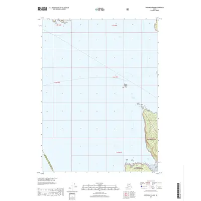
2017 Map of Ketchikan B-6 NW
USGS Topo · Published 2017About this map
Behm Canal and the Inside Passage dominate this maritime survey of the coastal waters northwest of Ketchikan. The map documents the intricate coastline of the Cleveland Peninsula, terminating at Caamano Point, and the northern reaches of Gravina Island. This area serves as a critical maritime corridor, where the Guard Islands stand as a central landmark for navigators transitioning between the larger channels. Significant portions of the landmass are protected as part of the Tongass National Forest, illustrating the intersection of federal wilderness management and the essential water routes of Southeast Alaska. Coastal features such as Vallenar Point and Vallenar Bay provide specific points of reference for those studying the hydrography and topography of the Alexander Archipelago.
Find a feature on this map
17 named features on this map. Tap any name to fly to it.
Don’t see what you’re looking for? This feature index may not catch every label — zoom into the map to look around manually.
Map Details
Editions of this 2017 Ketchikan B-6 NW Map
This is the sole edition of this map. No revisions or reprints were ever made.
Other maps of this area

1949 · Ketchikan C-6
USGS Topo · 1:63,360

1949 · Craig B-1
USGS Topo · 1:63,360

1950 · Craig B-1
USGS Topo · 1:63,360

1950 · Craig C-1
USGS Topo · 1:63,360

1951 · Craig C-1
USGS Topo · 1:63,360

1952 · Ketchikan
USGS Topo · 1:250,000

1952 · Ketchikan C-6
USGS Topo · 1:63,360

1953 · Ketchikan B-6
USGS Topo · 1:63,360

1954 · Ketchikan B-6
USGS Topo · 1:63,360

1955 · Ketchikan
USGS Topo · 1:250,000