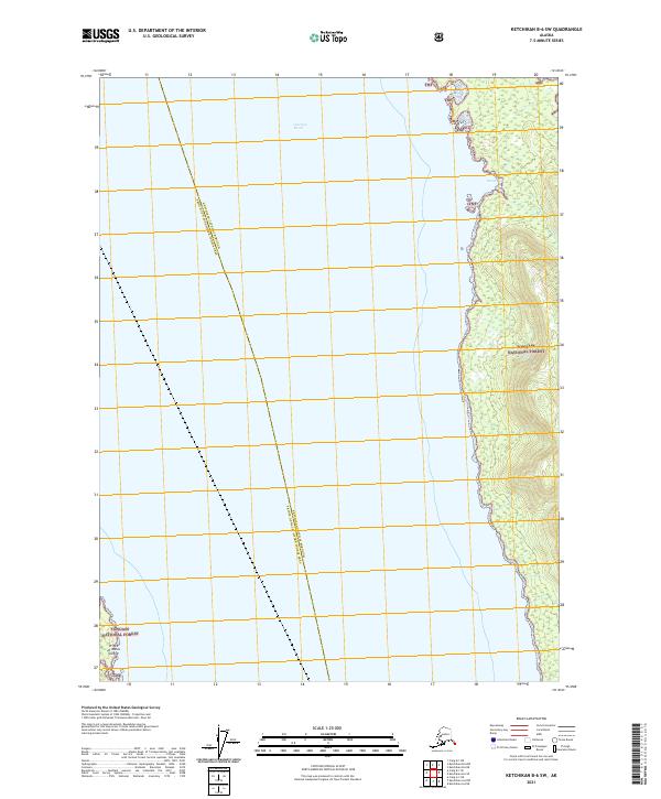
2021 Map of Ketchikan B-6 SW
USGS Topo · Published 2021About this map
Clarence Strait dominates this 2021 survey of Southeast Alaska's intricate coastline. The map details the eastern shoreline of Prince of Wales Island, where the island's steep, forested slopes descend directly into the deep waters of the strait. Within the protected confines of Grant Cove, the topography reveals the transition from tidal zones to the dense interior of the Tongass National Forest. The map also delineates the administrative boundary between the Ketchikan Gateway Borough and the Prince of Wales-Hyder Census Area, which runs through the center of the waterway. This modern topographic study provides an essential look at the remote wilderness of the Alexander Archipelago, where maritime navigation and forest management define the landscape.
Find a feature on this map
9 named features on this map. Tap any name to fly to it.
Don’t see what you’re looking for? This feature index may not catch every label — zoom into the map to look around manually.
Map Details
Editions of this 2021 Ketchikan B-6 SW Map
This is the sole edition of this map. No revisions or reprints were ever made.
Other maps of this area

1948 · Ketchikan A-6
USGS Topo · 1:63,360

1948 · Craig A-1
USGS Topo · 1:63,360

1949 · Craig B-1
USGS Topo · 1:63,360

1950 · Craig B-1
USGS Topo · 1:63,360

1952 · Ketchikan
USGS Topo · 1:250,000

1953 · Ketchikan B-6
USGS Topo · 1:63,360

1954 · Ketchikan B-6
USGS Topo · 1:63,360

1955 · Ketchikan
USGS Topo · 1:250,000

1957 · Craig
USGS Topo · 1:250,000
1991 · Ketchikan B-6 NE
USGS Topo · 1:25,000