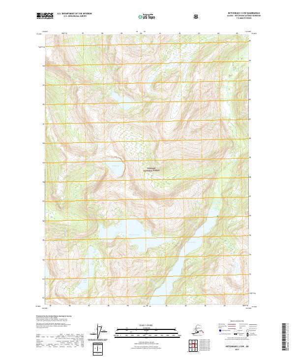
2021 Map of Ketchikan C-2 SW
USGS Topo · Published 2021About this map
Tongass National Forest dominates this section of the Ketchikan Gateway Borough, where high-elevation terrain is defined by a series of interconnected glacial valleys and significant alpine water bodies. The Wilson River cuts through the eastern portion of the landscape, fed by the waters of Wilson Lake. To the west, the topography centers on a cluster of notable basins including Big Goat Lake, Little Goat Lake, and Todd Lake. These features represent the quintessential coastal rainforest interior of Southeast Alaska, largely untouched by road infrastructure. The map provides precise elevation data for these remote watersheds, which are critical components of the regional ecosystem within the forest boundaries.
Find a feature on this map
10 named features on this map. Tap any name to fly to it.
Don’t see what you’re looking for? This feature index may not catch every label — zoom into the map to look around manually.
Map Details
Editions of this 2021 Ketchikan C-2 SW Map
This is the sole edition of this map. No revisions or reprints were ever made.
Other maps of this area

1952 · Ketchikan
USGS Topo · 1:250,000

1955 · Ketchikan C-3
USGS Topo · 1:63,360

1955 · Ketchikan C-2
USGS Topo · 1:63,360

1955 · Ketchikan B-2
USGS Topo · 1:63,360

1955 · Ketchikan B-3
USGS Topo · 1:63,360

1955 · Ketchikan
USGS Topo · 1:250,000

1996 · Ketchikan C-2
USGS Topo · 1:63,360
1996 · Ketchikan C-3
USGS Topo · 1:63,360
2018 · Ketchikan B-3 NE
USGS Topo · 1:25,000
2018 · Ketchikan B-2 NE
USGS Topo · 1:25,000