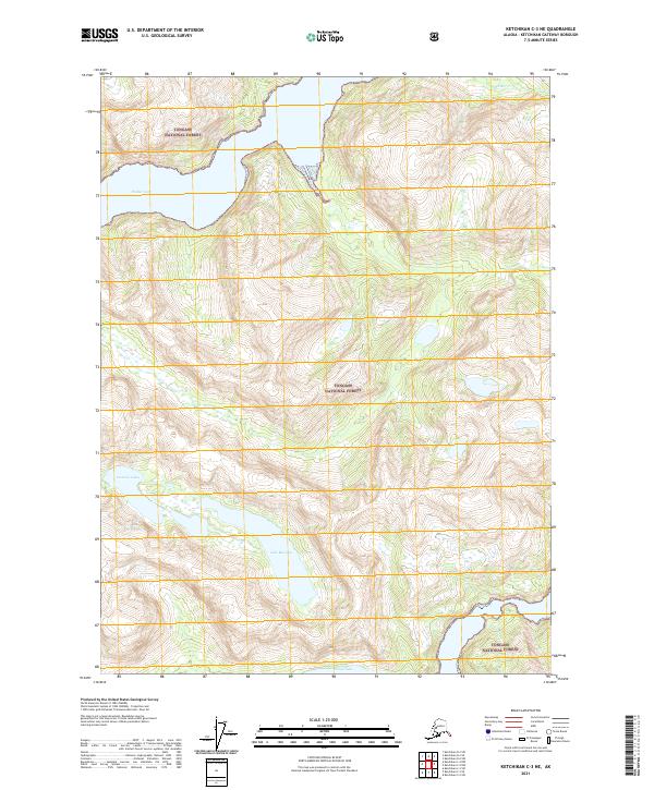
2021 Map of Ketchikan C-3 NE
USGS Topo · Published 2021About this map
The Tongass National Forest dominates this Alaskan landscape, where steep coastal terrain meets the glacial waters of the Pacific. At the northern edge, Walker Cove carves deep into the mainland, fed by the drainage of Walker Cr. The interior is defined by high-altitude basins holding significant bodies of water, most notably the centrally located Lake Manzoni. To the south, Nooya Lake sits near the coastline, while the Cessnun Lakes occupy a western valley. This survey reflects the modern management of these remote forest lands, documenting the intersection of sea-level inlets and the high alpine lakes that characterize the Southeast Alaska wilderness.
Find a feature on this map
11 named features on this map. Tap any name to fly to it.
Don’t see what you’re looking for? This feature index may not catch every label — zoom into the map to look around manually.
Map Details
Editions of this 2021 Ketchikan C-3 NE Map
This is the sole edition of this map. No revisions or reprints were ever made.
Other maps of this area

1952 · Ketchikan
USGS Topo · 1:250,000

1955 · Ketchikan C-3
USGS Topo · 1:63,360

1955 · Ketchikan D-2
USGS Topo · 1:63,360

1955 · Ketchikan C-2
USGS Topo · 1:63,360

1955 · Ketchikan D-3
USGS Topo · 1:63,360

1955 · Ketchikan
USGS Topo · 1:250,000

1996 · Ketchikan C-2
USGS Topo · 1:63,360
1996 · Ketchikan D-3
USGS Topo · 1:63,360
1996 · Ketchikan D-2
USGS Topo · 1:63,360
1996 · Ketchikan C-3
USGS Topo · 1:63,360