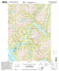
1996 Map of Ketchikan D-3
USGS Topo · Published 2000About this map
Behm Canal and the coastal waters of the Alexander Archipelago dominate this 1996 revision of the 1960 Ketchikan D-3 quadrangle. The map details the expansive Misty Fiords National Monument Wilderness, part of the larger Tongass National Forest, showcasing a complex network of glacial valleys and waterways. Principal drainage systems including the Chickamin River and Leduc River are shown alongside notable interior water bodies such as Leduc Lake, Saks Lake, and Heart Lake. The maritime geography is clearly defined by landmarks like Fish Point, Trap Point, and the Channel Islands at the entrance to Walker Cove. This survey reflects the remote, roadless character of the region, focusing on natural hydrology and coastal navigation markers.
Map Details
Editions of this 1996 Ketchikan D-3 Map
This is the sole edition of this map. No revisions or reprints were ever made.
Other maps of this area

1951 · Bradfield Canal
USGS Topo · 1:250,000

1952 · Ketchikan
USGS Topo · 1:250,000

1952 · Ketchikan C-4
USGS Topo · 1:63,360

1954 · Bradfield Canal
USGS Topo · 1:250,000

1955 · Ketchikan C-3
USGS Topo · 1:63,360

1955 · Ketchikan D-2
USGS Topo · 1:63,360

1955 · Bradfield canal A-4
USGS Topo · 1:63,360

1955 · Bradfield canal A-2
USGS Topo · 1:63,360

1955 · Ketchikan C-2
USGS Topo · 1:63,360

1955 · Ketchikan D-4
USGS Topo · 1:63,360