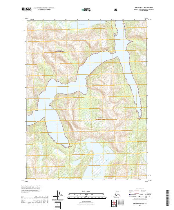
2021 Map of Ketchikan C-3 SE
USGS Topo · Published 2021About this map
Tongass National Forest dominates this coastal landscape, where steep fjord-like topography meets the waters of the Inside Passage. The map illustrates a dramatic wilderness defined by deep inlets, most notably Rudyerd Bay and Punchbowl Cove, which carve into the mountain faces. These glaciated features are surrounded by high-elevation water bodies like Nooya Lake and Punchbowl Lake, connected to the shoreline by the narrow Nooya Lake Trl. The lack of road infrastructure and the reliance on marine access points to the remote nature of this region, emphasizing its role as a protected forest environment. Public Land Survey System grids, including t72s r96e, provide a structured overlay to this otherwise untouched terrain, illustrating how modern administrative boundaries are applied to the wilderness of Southeast Alaska.
Find a feature on this map
11 named features on this map. Tap any name to fly to it.
Don’t see what you’re looking for? This feature index may not catch every label — zoom into the map to look around manually.
Map Details
Editions of this 2021 Ketchikan C-3 SE Map
This is the sole edition of this map. No revisions or reprints were ever made.
Other maps of this area

1952 · Ketchikan
USGS Topo · 1:250,000

1955 · Ketchikan C-3
USGS Topo · 1:63,360

1955 · Ketchikan C-2
USGS Topo · 1:63,360

1955 · Ketchikan B-2
USGS Topo · 1:63,360

1955 · Ketchikan B-3
USGS Topo · 1:63,360

1955 · Ketchikan
USGS Topo · 1:250,000

1996 · Ketchikan C-2
USGS Topo · 1:63,360
1996 · Ketchikan C-3
USGS Topo · 1:63,360
2018 · Ketchikan C-3 NW
USGS Topo · 1:25,000
2018 · Ketchikan B-3 NE
USGS Topo · 1:25,000