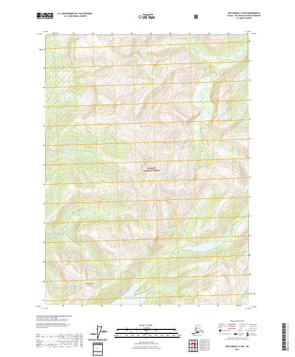
2021 Map of Ketchikan C-4 NW
USGS Topo · Published 2021About this map
Tongass National Forest dominates this Alaskan landscape, where the heights of Mt Reid overlook a complex network of glacial valleys and waterways. The map documents a section of Revillagigedo Island characterized by significant elevation changes, ranging from the shoreline of Swan Lake in the south to the high drainage basins of Falls Cr. The northern reaches of Upper Carroll are shown here, providing a detailed look at the hydrology of this rainforest environment before it reaches the sea. The Public Land Survey System grid identifies the administrative divisions of t71s r92e, t71s r93e, t72s r92e, and t72s r93e, which clarify land management boundaries within this largely undeveloped wilderness area of the Ketchikan Gateway Borough.
Find a feature on this map
9 named features on this map. Tap any name to fly to it.
Don’t see what you’re looking for? This feature index may not catch every label — zoom into the map to look around manually.
Map Details
Editions of this 2021 Ketchikan C-4 NW Map
This is the sole edition of this map. No revisions or reprints were ever made.
Other maps of this area

1948 · Ketchikan C-5
USGS Topo · 1:63,360

1952 · Ketchikan
USGS Topo · 1:250,000

1952 · Ketchikan C-4
USGS Topo · 1:63,360

1952 · Ketchikan D-5
USGS Topo · 1:63,360

1953 · Ketchikan C-5
USGS Topo · 1:63,360

1953 · Ketchikan D-5
USGS Topo · 1:63,360

1955 · Ketchikan D-4
USGS Topo · 1:63,360

1955 · Ketchikan C-4
USGS Topo · 1:63,360

1955 · Ketchikan
USGS Topo · 1:250,000
1962 · Ketchikan D-4
USGS Topo · 1:63,360