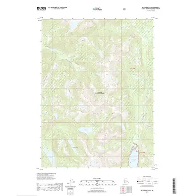
2017 Map of Ketchikan C-5 NE
USGS Topo · Published 2017About this map
Tongass National Forest dominates this coastal Alaska landscape, where steep maritime drainages meet the saltwater passages of the Gulf of Alaska. The interior terrain is defined by a dense network of freshwater bodies, including the centrally located Orton Lake, the isolated Snow Lake, and Chamberlain Lake to the southwest. These waters feed into systems like the Naha River and Traitors Creek, which carve through the high elevations of Carroll Bluff and the sharp incision of Bluff Draw. Modern forest management is evident in the inclusion of Traitors Creek Midwest 511 and other designated service roads. The map captures the meeting of land and sea at the Behm Canal, providing a detailed look at the hydrology and relief of the Ketchikan Gateway region during the early twenty-first century.
Find a feature on this map
20 named features on this map. Tap any name to fly to it.
Don’t see what you’re looking for? This feature index may not catch every label — zoom into the map to look around manually.
Map Details
Editions of this 2017 Ketchikan C-5 NE Map
This is the sole edition of this map. No revisions or reprints were ever made.
Other maps of this area

1948 · Ketchikan C-5
USGS Topo · 1:63,360

1952 · Ketchikan
USGS Topo · 1:250,000

1952 · Ketchikan C-4
USGS Topo · 1:63,360

1952 · Ketchikan D-5
USGS Topo · 1:63,360

1953 · Ketchikan C-5
USGS Topo · 1:63,360

1953 · Ketchikan D-5
USGS Topo · 1:63,360

1955 · Ketchikan D-4
USGS Topo · 1:63,360

1955 · Ketchikan C-4
USGS Topo · 1:63,360

1955 · Ketchikan
USGS Topo · 1:250,000
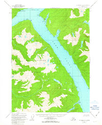
1962 · Ketchikan D-4
USGS Topo · 1:63,360