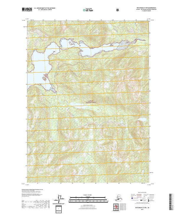
2021 Map of Ketchikan C-5 NW
USGS Topo · Published 2021About this map
Revillagigedo Island presents a landscape defined by the deep indentations of the Behm Canal and the sheltered waters of Traitors Cove. This portion of the Tongass National Forest illustrates a complex network of forest management routes, including the Margaret Road System Trl and the South Creek Road. The drainage patterns are clearly marked by the Margaret Creek South Fork East and Margaret Creek South Fork West, which feed into Margaret Lake before reaching the coast. Landmarks like Indian Point and the steep terrain surrounding Firebug provide essential reference points for navigating this maritime wilderness. The presence of specialized designations like the Marguerite Bay TTT and various spur roads reflects the ongoing utility and accessibility of this coastal forest region.
Find a feature on this map
22 named features on this map. Tap any name to fly to it.
Don’t see what you’re looking for? This feature index may not catch every label — zoom into the map to look around manually.
Map Details
Editions of this 2021 Ketchikan C-5 NW Map
This is the sole edition of this map. No revisions or reprints were ever made.
Other maps of this area

1948 · Ketchikan C-5
USGS Topo · 1:63,360

1949 · Ketchikan C-6
USGS Topo · 1:63,360

1952 · Ketchikan
USGS Topo · 1:250,000

1952 · Ketchikan C-6
USGS Topo · 1:63,360

1952 · Ketchikan D-5
USGS Topo · 1:63,360

1952 · Ketchikan D-6
USGS Topo · 1:63,360

1953 · Ketchikan C-5
USGS Topo · 1:63,360

1953 · Ketchikan D-5
USGS Topo · 1:63,360

1953 · Ketchikan D-6
USGS Topo · 1:63,360

1955 · Ketchikan
USGS Topo · 1:250,000