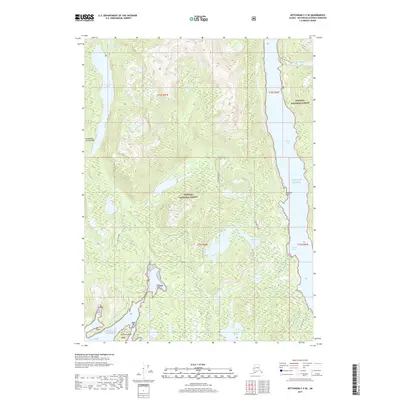
2017 Map of Ketchikan C-5 SE
USGS Topo · Published 2017About this map
Tongass National Forest dominates this coastal landscape within the Alexander Archipelago, where steep, forested terrain meets the intricate waterways of Southeast Alaska. Deep coastal indentations like Carroll Inlet and George Inlet define the maritime character of the area, providing natural harbors such as Shelter Cove. Inland, the high-elevation topography is dotted with glacial or rain-fed basins, including Chamberlain Lake, Patching Lake, and the connected waters of N Saddle Lake and S Saddle Lake.
Find a feature on this map
22 named features on this map. Tap any name to fly to it.
Don’t see what you’re looking for? This feature index may not catch every label — zoom into the map to look around manually.
Map Details
Editions of this 2017 Ketchikan C-5 SE Map
This is the sole edition of this map. No revisions or reprints were ever made.
Other maps of this area

1948 · Ketchikan C-5
USGS Topo · 1:63,360

1949 · Ketchikan B-4
USGS Topo · 1:63,360

1952 · Ketchikan
USGS Topo · 1:250,000

1952 · Ketchikan B-4
USGS Topo · 1:63,360

1952 · Ketchikan C-4
USGS Topo · 1:63,360

1953 · Ketchikan C-5
USGS Topo · 1:63,360

1954 · Ketchikan B-5
USGS Topo · 1:63,360

1955 · Ketchikan C-4
USGS Topo · 1:63,360

1955 · Ketchikan
USGS Topo · 1:250,000

1955 · Ketchikan B-5
USGS Topo · 1:63,360