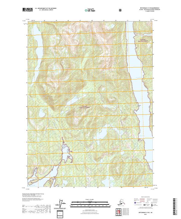
2021 Map of Ketchikan C-5 SE
USGS Topo · Published 2021About this map
The Tongass National Forest landscape across the Revillagigedo Island interior is defined by steep coastal topography and an intricate network of deep inlets and freshwater lakes. Carroll Inlet dominates the eastern coastline, while George Inlet and Tsa Cove penetrate the southwestern reaches, separated by landmarks like Nigelius Point and Bat Point. The map reveals the managed character of the forest through a system of trails and access routes, including the Swan Lake Access Road and the Ketchikan Shelter Tie. Freshwater resources are abundant, ranging from the large Patching Lake in the northwest to the high-elevation North Saddle Lake and South Saddle Lake further south. This 2021 update documents the contemporary state of the coastal wilderness, noting developed corridors like the 8337000 Road Trl that navigate between the steep ridges of t73s r92e.
Find a feature on this map
23 named features on this map. Tap any name to fly to it.
Don’t see what you’re looking for? This feature index may not catch every label — zoom into the map to look around manually.
Map Details
Editions of this 2021 Ketchikan C-5 SE Map
This is the sole edition of this map. No revisions or reprints were ever made.
Other maps of this area

1948 · Ketchikan C-5
USGS Topo · 1:63,360

1949 · Ketchikan B-4
USGS Topo · 1:63,360

1952 · Ketchikan
USGS Topo · 1:250,000

1952 · Ketchikan B-4
USGS Topo · 1:63,360

1952 · Ketchikan C-4
USGS Topo · 1:63,360

1953 · Ketchikan C-5
USGS Topo · 1:63,360

1954 · Ketchikan B-5
USGS Topo · 1:63,360

1955 · Ketchikan C-4
USGS Topo · 1:63,360

1955 · Ketchikan
USGS Topo · 1:250,000

1955 · Ketchikan B-5
USGS Topo · 1:63,360