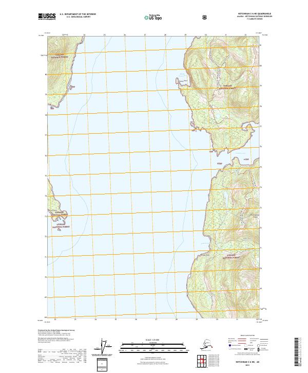
2021 Map of Ketchikan C-6 NE
USGS Topo · Published 2021About this map
Revillagigedo Island defines the eastern shoreline of this coastal reach, where the deep waters of the Inside Passage meet the western edge of the Tongass National Forest. The geography is characterized by several significant coastal indentations, most notably Bushy Point Cove and the northern entrance of Traitors Cove. These natural harbors are separated by prominent landmarks such as Bushy Point and Escape Point, which provided critical navigational waypoints for maritime travel. Inland, the map documents a series of forestry and access routes, including the Bushy Point Cove 8060500 Road Trl and the Flinger Lake Saddle Rd Margaret Trl, illustrating the network of land management tracks within the national forest. The southern portion of the sheet is marked by the mouth of Francis Cove Creek and the coastal feature Point Francis, showing the intersection of freshwater drainage and tidal inlets.
Find a feature on this map
23 named features on this map. Tap any name to fly to it.
Don’t see what you’re looking for? This feature index may not catch every label — zoom into the map to look around manually.
Map Details
Editions of this 2021 Ketchikan C-6 NE Map
This is the sole edition of this map. No revisions or reprints were ever made.
Other maps of this area

1948 · Ketchikan C-5
USGS Topo · 1:63,360

1949 · Ketchikan C-6
USGS Topo · 1:63,360

1952 · Ketchikan
USGS Topo · 1:250,000

1952 · Ketchikan C-6
USGS Topo · 1:63,360

1952 · Ketchikan D-5
USGS Topo · 1:63,360

1952 · Ketchikan D-6
USGS Topo · 1:63,360

1953 · Ketchikan C-5
USGS Topo · 1:63,360

1953 · Ketchikan D-5
USGS Topo · 1:63,360

1953 · Ketchikan D-6
USGS Topo · 1:63,360

1955 · Ketchikan
USGS Topo · 1:250,000