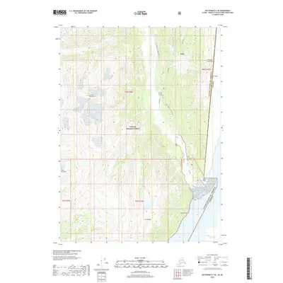
2018 Map of Ketchikan D-1 NE
USGS Topo · Published 2018About this map
Hyder sits at the edge of the international border in the Alaskan Panhandle, serving as a gateway to the high peaks and glacial valleys of the Tongass National Forest. This 2018 survey captures the interface between the United States and Canada, where the State Highway 12 Salmon River and Salmon River Road provide essential overland access along the river corridor. The landscape is defined by the massive elevations of the Coast Mountains, including Mt Hinckley and the Reverdy Mountains.
Find a feature on this map
25 named features on this map. Tap any name to fly to it.
Don’t see what you’re looking for? This feature index may not catch every label — zoom into the map to look around manually.
Map Details
Editions of this 2018 Ketchikan D-1 NE Map
This is the sole edition of this map. No revisions or reprints were ever made.
Other maps of this area

1951 · Bradfield Canal
USGS Topo · 1:250,000

1952 · Ketchikan
USGS Topo · 1:250,000

1954 · Bradfield Canal
USGS Topo · 1:250,000

1955 · Bradfield Canal A-1
USGS Topo · 1:63,360

1955 · Ketchikan D-1
USGS Topo · 1:63,360

1955 · Ketchikan
USGS Topo · 1:250,000

1955 · Bradfield Canal
USGS Topo · 1:250,000
1996 · Bradfield Canal A-1
USGS Topo · 1:63,360
1997 · Bradfield Canal A-1
USGS Topo · 1:63,360
2000 · Bradfield Canal A-1
USGS Topo · 1:63,360