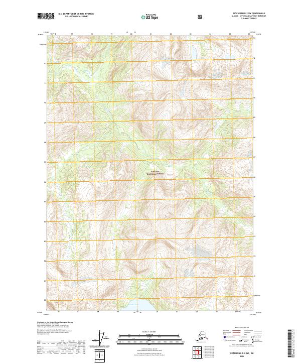
2021 Map of Ketchikan D-2 SW
USGS Topo · Published 2021About this map
Tongass National Forest dominates this topographic landscape in the Alexander Archipelago region of Southeast Alaska. This interior portion of the rainforest is defined by sharp elevation shifts and steep drainage basins, notably around the S Fork Chickamin River in the northwest. In the southern portion of the quadrangle, Walker Lake sits at the base of several high ridges, providing a significant water feature in a terrain otherwise characterized by seasonal runoff and minor tributaries like Barrier Cr. This 2021 survey illustrates the management of these remote public lands through the Public Land Survey System, with grid lines for t69s r96e, t69s r97e, and adjacent townships providing the primary human-imposed structure on an otherwise wild landscape.
Find a feature on this map
8 named features on this map. Tap any name to fly to it.
Don’t see what you’re looking for? This feature index may not catch every label — zoom into the map to look around manually.
Map Details
Editions of this 2021 Ketchikan D-2 SW Map
This is the sole edition of this map. No revisions or reprints were ever made.
Other maps of this area

1952 · Ketchikan
USGS Topo · 1:250,000

1955 · Ketchikan C-3
USGS Topo · 1:63,360

1955 · Ketchikan D-2
USGS Topo · 1:63,360

1955 · Ketchikan C-2
USGS Topo · 1:63,360

1955 · Ketchikan D-3
USGS Topo · 1:63,360

1955 · Ketchikan
USGS Topo · 1:250,000

1996 · Ketchikan C-2
USGS Topo · 1:63,360
1996 · Ketchikan D-3
USGS Topo · 1:63,360
1996 · Ketchikan D-2
USGS Topo · 1:63,360
1996 · Ketchikan C-3
USGS Topo · 1:63,360