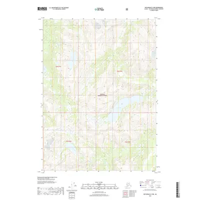
2018 Map of Ketchikan D-3 NW
USGS Topo · Published 2018About this map
Tongass National Forest dominates this coastal Alaskan landscape, where the terrain is defined by dramatic drainage networks and glacial lakes. In the northwest, Saks Lake feeds into the winding Saks Cr, while the central portion of the map is anchored by the substantial Leduc Lake. The southern reaches are characterized by the bifurcating waters of Humpy Creek and Humpy Cr, illustrating the intricate hydrological patterns of the Ketchikan Gateway Borough. This 2018 survey provides a clear look at the township and range boundaries, including t68s r94e and t69s r94e, which organize this largely roadless wilderness for federal management and environmental tracking.
Find a feature on this map
10 named features on this map. Tap any name to fly to it.
Don’t see what you’re looking for? This feature index may not catch every label — zoom into the map to look around manually.
Map Details
Editions of this 2018 Ketchikan D-3 NW Map
This is the sole edition of this map. No revisions or reprints were ever made.
Other maps of this area

1951 · Bradfield Canal
USGS Topo · 1:250,000

1952 · Ketchikan
USGS Topo · 1:250,000

1954 · Bradfield Canal
USGS Topo · 1:250,000

1955 · Bradfield canal A-4
USGS Topo · 1:63,360

1955 · Ketchikan D-4
USGS Topo · 1:63,360

1955 · Ketchikan D-3
USGS Topo · 1:63,360

1955 · Bradfield canal A-3
USGS Topo · 1:63,360

1955 · Ketchikan
USGS Topo · 1:250,000

1955 · Bradfield Canal
USGS Topo · 1:250,000
1962 · Ketchikan D-4
USGS Topo · 1:63,360