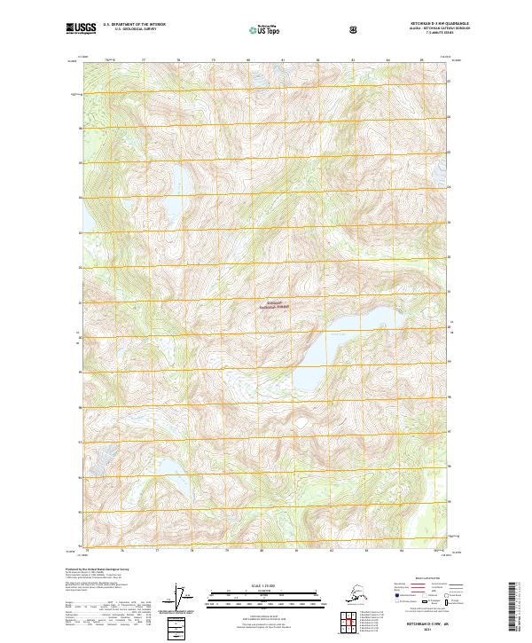
2021 Map of Ketchikan D-3 NW
USGS Topo · Published 2021About this map
Tongass National Forest defines the environment of this coastal Alaska region, where the landscape is characterized by high-altitude freshwater systems and steep drainages. Central to this survey is Leduc Lake, a prominent body of water situated in the heart of the terrain. The hydrological network is further shaped by the flow of Saks Creek (also labeled Saks Cr) to the north and Humpy Creek (marked as Humpy Cr) to the south. Produced by the U.S. Geological Survey using 2018–2020 imagery, this map documents a roadless wilderness area where elevation and water provide the primary geographical markers. The data reveals the natural drainage patterns of these named creeks as they navigate the complex topography within the Forest Service boundaries.
Find a feature on this map
10 named features on this map. Tap any name to fly to it.
Don’t see what you’re looking for? This feature index may not catch every label — zoom into the map to look around manually.
Map Details
Editions of this 2021 Ketchikan D-3 NW Map
This is the sole edition of this map. No revisions or reprints were ever made.
Other maps of this area

1951 · Bradfield Canal
USGS Topo · 1:250,000

1952 · Ketchikan
USGS Topo · 1:250,000

1954 · Bradfield Canal
USGS Topo · 1:250,000

1955 · Bradfield canal A-4
USGS Topo · 1:63,360

1955 · Ketchikan D-4
USGS Topo · 1:63,360

1955 · Ketchikan D-3
USGS Topo · 1:63,360

1955 · Bradfield canal A-3
USGS Topo · 1:63,360

1955 · Ketchikan
USGS Topo · 1:250,000

1955 · Bradfield Canal
USGS Topo · 1:250,000
1962 · Ketchikan D-4
USGS Topo · 1:63,360