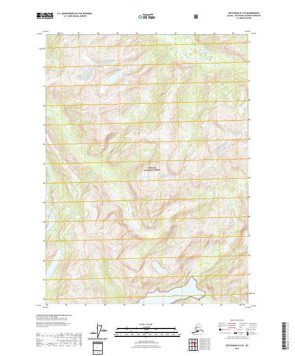
2021 Map of Ketchikan D-3 SE
USGS Topo · Published 2021About this map
Tongass National Forest lands dominate this coastal Alaskan landscape, where the saltwater of Walker Cove cuts into the southern edge of the sheet. The terrain is defined by its dramatic glacial carved valleys and drainage systems, including the S Fork Chickamin River in the north and the prominent King Cr that feeds through the central mountains. In the southwest, Gilbert Lake sits in an elevated basin, surrounded by a complex network of smaller tributaries like Choca Cr. This modern survey reflects a wilderness area without established roads or settlements, primarily used by the Alaska Dept. of Transportation and the Forest Service for resource management. The map serves as a primary record of the hydrological patterns of the Ketchikan Gateway Borough, detailing the relationship between mountain snowmelt and the coastal inlets of the Alexander Archipelago.
Find a feature on this map
11 named features on this map. Tap any name to fly to it.
Don’t see what you’re looking for? This feature index may not catch every label — zoom into the map to look around manually.
Map Details
Editions of this 2021 Ketchikan D-3 SE Map
This is the sole edition of this map. No revisions or reprints were ever made.
Other maps of this area

1952 · Ketchikan
USGS Topo · 1:250,000

1955 · Ketchikan C-3
USGS Topo · 1:63,360

1955 · Ketchikan D-2
USGS Topo · 1:63,360

1955 · Ketchikan C-2
USGS Topo · 1:63,360

1955 · Ketchikan D-3
USGS Topo · 1:63,360

1955 · Ketchikan
USGS Topo · 1:250,000

1996 · Ketchikan C-2
USGS Topo · 1:63,360
1996 · Ketchikan D-3
USGS Topo · 1:63,360
1996 · Ketchikan D-2
USGS Topo · 1:63,360
1996 · Ketchikan C-3
USGS Topo · 1:63,360