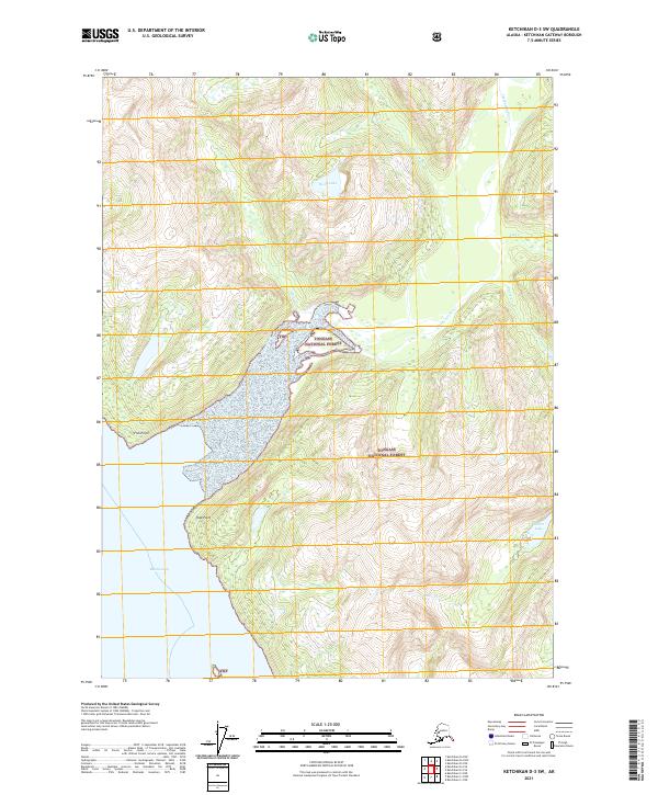
2021 Map of Ketchikan D-3 SW
USGS Topo · Published 2021About this map
Tongass National Forest dominates this coastal landscape, where the tidal waters of Behm Canal meet the steep-sided terrain of the Alaskan panhandle. The area is defined by its dramatic hydrography, particularly the Chickamin River which flows into the canal near Humpy Cr. This survey illustrates the intricate relationship between the mountainous interior and the shoreline, featuring prominent maritime landmarks such as Fish Point and Trap Point.
Find a feature on this map
16 named features on this map. Tap any name to fly to it.
Don’t see what you’re looking for? This feature index may not catch every label — zoom into the map to look around manually.
Map Details
Editions of this 2021 Ketchikan D-3 SW Map
This is the sole edition of this map. No revisions or reprints were ever made.
Other maps of this area

1952 · Ketchikan
USGS Topo · 1:250,000

1952 · Ketchikan C-4
USGS Topo · 1:63,360

1955 · Ketchikan C-3
USGS Topo · 1:63,360

1955 · Ketchikan D-4
USGS Topo · 1:63,360

1955 · Ketchikan D-3
USGS Topo · 1:63,360

1955 · Ketchikan C-4
USGS Topo · 1:63,360

1955 · Ketchikan
USGS Topo · 1:250,000
1962 · Ketchikan D-4
USGS Topo · 1:63,360
1995 · Ketchikan C-4
USGS Topo · 1:63,360
1996 · Ketchikan D-4
USGS Topo · 1:63,360