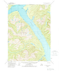
1955 Map of Ketchikan D-4
USGS Topo · Published 1963About this map
Behm Canal dominates the center of this coastal wilderness, separating the eastern mainland from the steep terrain of Revillagigedo Island. This 1950s survey captures the region within the Tongass National Forest, documenting a landscape defined by deep fjords and maritime navigation points. To the north, Burroughs Bay meets the mainland at the mouth of tidal flats, while numerous points such as Pt Whaley and Pt Fitzgibbon mark the winding shoreline. The map's hydrographic data reveals a complex network of drainages including Orchard Creek and Saks Creek, which flow through heavily contoured valleys into protected waters like Fitzgibbon Cove and Saks Cove. Triangulation stations, noted as VABM markers, are scattered across the high ridges, indicating the precise geodetic work required to map this roadless section of Southeast Alaska.
Find a feature on this map
30 named features on this map. Tap any name to fly to it.
Don’t see what you’re looking for? This feature index may not catch every label — zoom into the map to look around manually.
Map Details
Editions of this 1955 Ketchikan D-4 Map
2 editions found

Other maps of this area

1948 · Ketchikan C-5
USGS Topo · 1:63,360

1951 · Bradfield Canal
USGS Topo · 1:250,000

1952 · Ketchikan
USGS Topo · 1:250,000

1952 · Ketchikan C-4
USGS Topo · 1:63,360

1952 · Ketchikan D-5
USGS Topo · 1:63,360

1953 · Ketchikan C-5
USGS Topo · 1:63,360

1953 · Ketchikan D-5
USGS Topo · 1:63,360

1954 · Bradfield Canal
USGS Topo · 1:250,000

1955 · Ketchikan C-3
USGS Topo · 1:63,360

1955 · Bradfield canal A-4
USGS Topo · 1:63,360