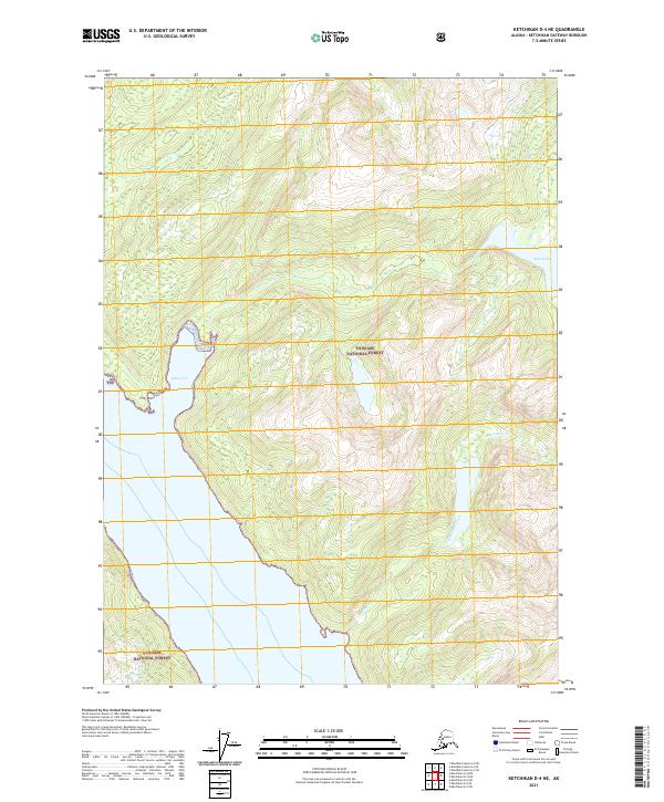
2021 Map of Ketchikan D-4 NE
USGS Topo · Published 2021About this map
Tongass National Forest dominates this coastal landscape in the Prince of Wales-Hyder region of Alaska. The map traces the intricate drainage of Saks Cr, which flows from the interior peaks down to Saks Lake before meeting the saltwater at Saks Cove. This maritime interface is anchored by Fire Point, a distinct geographic feature overlooking the coastal waters. Further south, the terrain is carved by the winding paths of Robinson Creek and its tributary, Robinson Cr. The survey illustrates the steep elevation changes and dense forestry typical of the Alexander Archipelago, showing how these freshwater systems navigate the complex topography of the Tongass.
Find a feature on this map
12 named features on this map. Tap any name to fly to it.
Don’t see what you’re looking for? This feature index may not catch every label — zoom into the map to look around manually.
Map Details
Editions of this 2021 Ketchikan D-4 NE Map
This is the sole edition of this map. No revisions or reprints were ever made.
Other maps of this area

1951 · Bradfield Canal
USGS Topo · 1:250,000

1952 · Ketchikan
USGS Topo · 1:250,000

1954 · Bradfield Canal
USGS Topo · 1:250,000

1955 · Bradfield canal A-4
USGS Topo · 1:63,360

1955 · Ketchikan D-4
USGS Topo · 1:63,360

1955 · Ketchikan D-3
USGS Topo · 1:63,360

1955 · Bradfield canal A-3
USGS Topo · 1:63,360

1955 · Ketchikan
USGS Topo · 1:250,000

1955 · Bradfield Canal
USGS Topo · 1:250,000
1962 · Ketchikan D-4
USGS Topo · 1:63,360