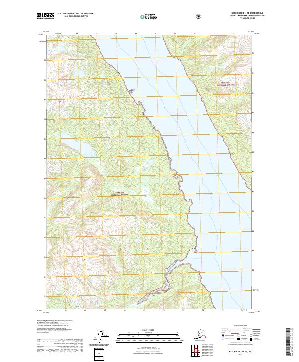
2021 Map of Ketchikan D-4 SE
USGS Topo · Published 2021About this map
Tongass National Forest dominates this coastal landscape in the Alexander Archipelago, showing a wilderness of steep contours and significant elevation gains within the Ketchikan Gateway Borough. The topography is defined by the narrow passage between landmasses, where the shorelines of Portage Cove meet the coastal forest. This 2021 study illustrates the complex system of public land surveys, mapping out township and range lines such as t70s r93e and t70s r94e across the timbered slopes. The absence of roads or established settlements on this sheet highlights the characteristic isolation of the region's coastal rainforest, with only the abbreviated TNF markers identifying the vast federal forest management area.
Find a feature on this map
7 named features on this map. Tap any name to fly to it.
Don’t see what you’re looking for? This feature index may not catch every label — zoom into the map to look around manually.
Map Details
Editions of this 2021 Ketchikan D-4 SE Map
This is the sole edition of this map. No revisions or reprints were ever made.
Other maps of this area

1952 · Ketchikan
USGS Topo · 1:250,000

1952 · Ketchikan C-4
USGS Topo · 1:63,360

1955 · Ketchikan C-3
USGS Topo · 1:63,360

1955 · Ketchikan D-4
USGS Topo · 1:63,360

1955 · Ketchikan D-3
USGS Topo · 1:63,360

1955 · Ketchikan C-4
USGS Topo · 1:63,360

1955 · Ketchikan
USGS Topo · 1:250,000
1962 · Ketchikan D-4
USGS Topo · 1:63,360
1995 · Ketchikan C-4
USGS Topo · 1:63,360
1996 · Ketchikan D-4
USGS Topo · 1:63,360