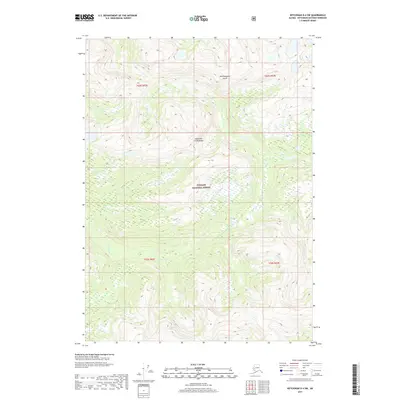
2017 Map of Ketchikan D-4 SW
USGS Topo · Published 2017About this map
Revillagigedo Island dominates this portion of the Alexander Archipelago, where the dense drainage patterns of the Tongass National Forest are mapped in detail. The landscape is defined by its dramatic relief and water systems, notably the winding paths of Orchard Cr and Cow Cr. This 2017 topographic study highlights the primary wilderness character of the region, emphasizing the complex network of unnamed peaks and valleys that characterize the coastal forests of Southeast Alaska. Without roads or permanent settlements recorded, the map serves as a vital record of the natural hydrology and land divisions, including specific township and range boundaries like t69s r92e and t70s r93e that organize this remote terrain.
Find a feature on this map
9 named features on this map. Tap any name to fly to it.
Don’t see what you’re looking for? This feature index may not catch every label — zoom into the map to look around manually.
Map Details
Editions of this 2017 Ketchikan D-4 SW Map
This is the sole edition of this map. No revisions or reprints were ever made.
Other maps of this area

1948 · Ketchikan C-5
USGS Topo · 1:63,360

1952 · Ketchikan
USGS Topo · 1:250,000

1952 · Ketchikan C-4
USGS Topo · 1:63,360

1952 · Ketchikan D-5
USGS Topo · 1:63,360

1953 · Ketchikan C-5
USGS Topo · 1:63,360

1953 · Ketchikan D-5
USGS Topo · 1:63,360

1955 · Ketchikan D-4
USGS Topo · 1:63,360

1955 · Ketchikan C-4
USGS Topo · 1:63,360

1955 · Ketchikan
USGS Topo · 1:250,000
1962 · Ketchikan D-4
USGS Topo · 1:63,360