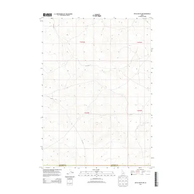
2013 Map of Kettle Butte NW
USGS Topo · Published 2013About this map
Jefferson and Bonneville Counties meet in this high-desert landscape of eastern Idaho, characterized by sparse infrastructure and significant elevation changes. The land is largely defined by its cadastral grid, falling within Township 5 North, Range 34 East and Township 4 North, Range 34 East, indicating a region dominated by large-scale agricultural or public land management. Human presence is marked primarily by a handful of established thoroughfares, such as Little Burn Rd and Sheep Rd, which navigate the undulating contours. These routes, along with Mud Lake Rd, likely served as vital connections for local ranching operations or seasonal access between the Snake River Plain and the surrounding highlands. The absence of dense settlement highlights the open, rural character of the region as it transitioned into the early 21st century.
Find a feature on this map
9 named features on this map. Tap any name to fly to it.
Don’t see what you’re looking for? This feature index may not catch every label — zoom into the map to look around manually.
Map Details
Editions of this 2013 Kettle Butte NW Map
This is the sole edition of this map. No revisions or reprints were ever made.
Other maps of this area

1955 · Idaho Falls
USGS Topo · 1:250,000

1958 · Idaho Falls
USGS Topo · 1:250,000

1964 · Kettle Butte NE
USGS Topo · 1:24,000

1964 · Kettle Butte NW
USGS Topo · 1:24,000

1964 · Kettle Butte SW
USGS Topo · 1:24,000

1964 · Terreton
USGS Topo · 1:24,000
1964 · Butterfly Butte
USGS Topo · 1:24,000

1964 · Mud Lake SE
USGS Topo · 1:24,000

1969 · Antelope Butte
USGS Topo · 1:24,000

1973 · Little Butte NE
USGS Topo · 1:24,000