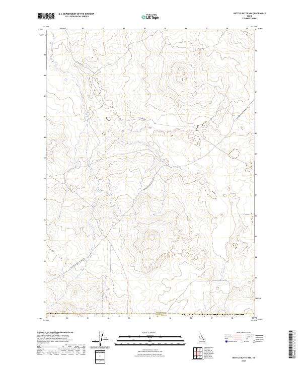
2023 Map of Kettle Butte NW
USGS Topo · Published 2023About this map
The high-desert terrain of the upper Snake River Plain is defined here by its intersection of historical land boundaries and contemporary access roads. Spanning the border of Jefferson Co and Bonneville Co, the landscape transitions through several township and range sections, including t4n r34e and t5n r35e. The infrastructure is sparse, characterized by long-distance thoroughfares that cut across the open country, providing vital links through an otherwise unpopulated volcanic landscape. The course of Little Burn Rd and the diagonally oriented Twin Butte Sage Junction Rd trace the movement of modern ranching and utility access across this expansive volcanic plateau, illustrating the enduring pattern of remote western land management where township lines still dictate the geometry of the territory.
Find a feature on this map
11 named features on this map. Tap any name to fly to it.
Don’t see what you’re looking for? This feature index may not catch every label — zoom into the map to look around manually.
Map Details
Editions of this 2023 Kettle Butte NW Map
This is the sole edition of this map. No revisions or reprints were ever made.
Other maps of this area

1955 · Idaho Falls
USGS Topo · 1:250,000

1958 · Idaho Falls
USGS Topo · 1:250,000

1964 · Kettle Butte NE
USGS Topo · 1:24,000

1964 · Kettle Butte NW
USGS Topo · 1:24,000

1964 · Kettle Butte SW
USGS Topo · 1:24,000

1964 · Terreton
USGS Topo · 1:24,000
1964 · Butterfly Butte
USGS Topo · 1:24,000

1964 · Mud Lake SE
USGS Topo · 1:24,000

1969 · Antelope Butte
USGS Topo · 1:24,000

1973 · Little Butte NE
USGS Topo · 1:24,000