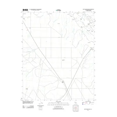
2012 Map of Kettleman Plain
USGS Topo · Published 2012About this map
Kettleman Plain serves as the central focal point for this 2012 survey, defining a landscape shaped by both hydrology and petroleum exploration history. The eastern terrain is marked by a series of distinct ridges and arroyos, including Bullwheel Ridge and Drillers Ridge, names that reflect the region’s long-standing connection to the oil industry. A network of seasonal waterways, such as Arroyo Robador and Arroyo Delgado, drain the uplands toward the plain below.
Find a feature on this map
42 named features on this map. Tap any name to fly to it.
Don’t see what you’re looking for? This feature index may not catch every label — zoom into the map to look around manually.
Map Details
Editions of this 2012 Kettleman Plain Map
This is the sole edition of this map. No revisions or reprints were ever made.
Other maps of this area

1912 · Coalinga
USGS Topo · 1:125,000

1914 · Lost Hills
USGS Topo · 1:125,000

1914 · Cholame
USGS Topo · 1:125,000

1915 · Cholame
USGS Topo · 1:125,000

1917 · Cholame
USGS Topo · 1:125,000

1930 · Discovery Well
USGS Topo · 1:31,680

1930 · Avenal Gap
USGS Topo · 1:31,680

1930 · Canoas Creek
USGS Topo · 1:31,680

1930 · Kettleman Plain
USGS Topo · 1:31,680

1930 · Middle Dome
USGS Topo · 1:31,680