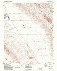
1994 Map of Kettleman Plain
USGS Topo · Published 1994About this map
The Avenal State Prison complex anchors the northwestern corner of this landscape, positioned just south of the city's corporate boundary. This 1994 map documents a rugged industrial and agricultural corridor where the Kettleman Hills rise sharply from the flat Kettleman Plain. The terrain is deeply etched by numerous seasonal watercourses, such as Arroyo del Medio, Arroyo Drifters, and Arroyo del Paso, which drain from the higher elevations of Bullwheel Ridge and Cerro Ultimo.
Find a feature on this map
33 named features on this map. Tap any name to fly to it.
Don’t see what you’re looking for? This feature index may not catch every label — zoom into the map to look around manually.
Map Details
Editions of this 1994 Kettleman Plain Map
This is the sole edition of this map. No revisions or reprints were ever made.
Other maps of this area

1912 · Coalinga
USGS Topo · 1:125,000

1914 · Lost Hills
USGS Topo · 1:125,000

1914 · Cholame
USGS Topo · 1:125,000

1915 · Cholame
USGS Topo · 1:125,000

1917 · Cholame
USGS Topo · 1:125,000

1930 · Discovery Well
USGS Topo · 1:31,680

1930 · Avenal Gap
USGS Topo · 1:31,680

1930 · Canoas Creek
USGS Topo · 1:31,680

1930 · Kettleman Plain
USGS Topo · 1:31,680

1930 · Middle Dome
USGS Topo · 1:31,680