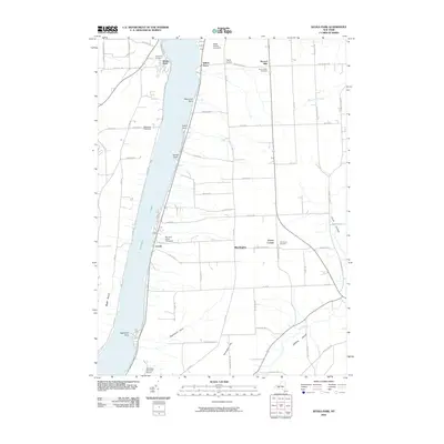
2010 Map of Keuka Park
USGS Topo · Published 2010About this map
Keuka Lake and the agricultural landscapes of Yates County define this 2010 survey of the Finger Lakes region. The eastern shore is characterized by several distinctive points, including Raymond Point, Hewitt Point, and Sunset Point, where the shoreline meets the steep rise of the surrounding hills. This era of the landscape is marked by the proliferation of the viticulture industry, with several established operations such as Keuka Spring Vineyards, Simmons Vineyard, and McGregor Vineyard Winery situated on the slopes overlooking the water. Away from the lakefront, the map details established rural hamlets like Second Milo, Thayer Corners, and Porter Corner. Genealogists will find notable value in the precisely marked locations of the Keuka Park Cemetery, Second Milo Cemetery, and Barrington Cemetery, which anchor these long-standing communities. The drainage patterns of the upland areas are traced through Plum Point Creek and the deep ravine of Eggleston Glen.
Find a feature on this map
68 named features on this map. Tap any name to fly to it.
Don’t see what you’re looking for? This feature index may not catch every label — zoom into the map to look around manually.
Map Details
Editions of this 2010 Keuka Park Map
This is the sole edition of this map. No revisions or reprints were ever made.
Other maps of this area

1898 · Watkins Glen
USGS Topo · 1:62,500

1901 · Watkins
USGS Topo · 1:62,500

1902 · Ovid
USGS Topo · 1:62,500

1903 · Penn Yan
USGS Topo · 1:62,500

1903 · Hammondsport
USGS Topo · 1:62,500

1905 · Watkins Glen
USGS Topo · 1:125,000

1942 · Penn Yan
USGS Topo · 1:31,680

1942 · Pulteney
USGS Topo · 1:31,680

1942 · Potter
USGS Topo · 1:31,680

1942 · Dundee
USGS Topo · 1:24,000