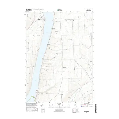
2016 Map of Keuka Park
USGS Topo · Published 2016About this map
Keuka Lake dominates this Finger Lakes landscape, where the distinct topography of the Bluff Point peninsula divides the western and central branches of the water. This 2016 survey shows the established rural and lakeside settlements of Keuka Park, Barrington, and Crosby, as well as the numerous small landings and points that line the shore such as Raymond Point and Hewitt Point. To the east, the terrain rises toward Barrington Hill, dissected by watercourses like Plum Point Cr and Big Stream. The map is particularly useful for genealogical research, identifying several local burial grounds including Keuka Park Cem, Second Milo Cem, and Barrington Cem. The dense network of local roads, such as Skyline Dr and Kinneys Corners Rd, reflects the area's history as a mix of agricultural land and lakeside residential clusters.
Find a feature on this map
73 named features on this map. Tap any name to fly to it.
Don’t see what you’re looking for? This feature index may not catch every label — zoom into the map to look around manually.
Map Details
Editions of this 2016 Keuka Park Map
This is the sole edition of this map. No revisions or reprints were ever made.
Other maps of this area

1898 · Watkins Glen
USGS Topo · 1:62,500

1901 · Watkins
USGS Topo · 1:62,500

1902 · Ovid
USGS Topo · 1:62,500

1903 · Penn Yan
USGS Topo · 1:62,500

1903 · Hammondsport
USGS Topo · 1:62,500

1905 · Watkins Glen
USGS Topo · 1:125,000

1942 · Penn Yan
USGS Topo · 1:31,680

1942 · Pulteney
USGS Topo · 1:31,680

1942 · Potter
USGS Topo · 1:31,680

1942 · Dundee
USGS Topo · 1:24,000