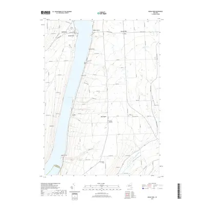
2019 Map of Keuka Park
USGS Topo · Published 2019About this map
Keuka Lake dominates the western portion of this Finger Lakes landscape, where the bifurcated West Branch and East Branch meet at Bluff Point. The shoreline is marked by a series of points and glens, including Raymond Point and Eggleston Glen, while the uplands of Yates Co feature agricultural and residential patterns characteristic of the early 21st century. The settlement of Keuka Park is anchored by the presence of Keuka College, established near the water's edge. Further inland, smaller crossroads and hamlets like Second Milo, Crosby, and Barrington provide a glimpse into the rural community structure of the region. Local history and genealogy are preserved in sites such as Second Milo Cem and Porters Corners Cem. The southern edge of the survey transitions toward the Steuben County line near Crystal Valley.
Find a feature on this map
86 named features on this map. Tap any name to fly to it.
Don’t see what you’re looking for? This feature index may not catch every label — zoom into the map to look around manually.
Map Details
Editions of this 2019 Keuka Park Map
This is the sole edition of this map. No revisions or reprints were ever made.
Other maps of this area

1898 · Watkins Glen
USGS Topo · 1:62,500

1901 · Watkins
USGS Topo · 1:62,500

1902 · Ovid
USGS Topo · 1:62,500

1903 · Penn Yan
USGS Topo · 1:62,500

1903 · Hammondsport
USGS Topo · 1:62,500

1905 · Watkins Glen
USGS Topo · 1:125,000

1942 · Penn Yan
USGS Topo · 1:31,680

1942 · Pulteney
USGS Topo · 1:31,680

1942 · Potter
USGS Topo · 1:31,680

1942 · Dundee
USGS Topo · 1:24,000