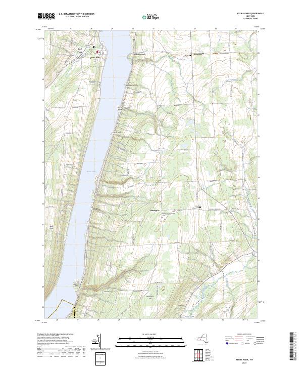
2023 Map of Keuka Park
USGS Topo · Published 2023About this map
Keuka Lake and the high ridges of Yates County define this landscape, where the waters split around the prominent landmass of Bluff Point. The eastern branch of the lake is lined with established lakeside settlements such as Willow Grove, Crosby, and Eggleston Point, while the upland interior is marked by the agricultural hamlets of Barrington and Second Milo. The campus of Keuka College serves as a significant institutional landmark at Keuka Park, situated near the shoreline.
Find a feature on this map
88 named features on this map. Tap any name to fly to it.
Don’t see what you’re looking for? This feature index may not catch every label — zoom into the map to look around manually.
Map Details
Editions of this 2023 Keuka Park Map
This is the sole edition of this map. No revisions or reprints were ever made.
Other maps of this area

1898 · Watkins Glen
USGS Topo · 1:62,500

1901 · Watkins
USGS Topo · 1:62,500

1902 · Ovid
USGS Topo · 1:62,500

1903 · Penn Yan
USGS Topo · 1:62,500

1903 · Hammondsport
USGS Topo · 1:62,500

1905 · Watkins Glen
USGS Topo · 1:125,000

1942 · Penn Yan
USGS Topo · 1:31,680

1942 · Pulteney
USGS Topo · 1:31,680

1942 · Potter
USGS Topo · 1:31,680

1942 · Dundee
USGS Topo · 1:24,000