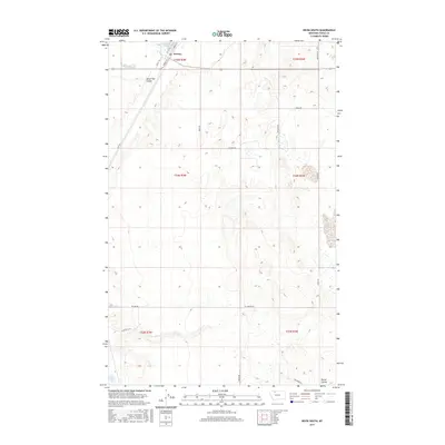
2017 Map of Kevin South
USGS Topo · Published 2017About this map
Kevin anchors the northern boundary of this Toole County landscape, where the high plains are defined by glacial depressions and seasonal watercourses. The drainage patterns of Alkali Flat Coulee and Potter Coulee cut through the terrain, leading toward basin features such as Goedertz Lake and Aloe Lake. This environment, mapped in the modern era, reflects a sparse but organized settlement pattern dictated by the Public Land Survey System, as seen in the grid of township and range lines like t34n r3w. A network of rural roads, including Aloe Rd and Potter Rd, connects isolated farmsteads and provides access to the region's scattered wetlands and low-lying coulees. The map provides a clear view of the transition between cultivated land and the natural topography characteristic of this part of Montana.
Find a feature on this map
24 named features on this map. Tap any name to fly to it.
Don’t see what you’re looking for? This feature index may not catch every label — zoom into the map to look around manually.
Map Details
Editions of this 2017 Kevin South Map
This is the sole edition of this map. No revisions or reprints were ever made.
Other maps of this area

1909 · Cut Bank
USGS Topo · 1:125,000

1912 · Cut Bank
USGS Topo · 1:125,000

1939 · Sunburst
USGS Topo · 1:62,500

1943 · Shelby
USGS Topo · 1:62,500

1954 · Shelby
USGS Topo · 1:250,000

1958 · Shelby
USGS Topo · 1:250,000

1960 · Cut Bank
USGS Topo · 1:250,000

1963 · Cut Bank
USGS Topo · 1:250,000

1964 · Cut Bank
USGS Topo · 1:250,000
1966 · Ethridge
USGS Topo · 1:24,000