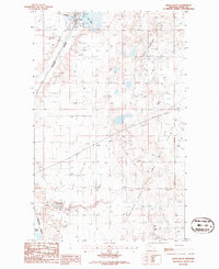
1986 Map of Kevin South
USGS Topo · Published 1986About this map
Industrial energy production and agricultural land use define this 1980s landscape in Toole County. The small settlement of Kevin is situated at the northern edge, bordered by Goedertz Lake and an extensive Lake Bed. The region is dominated by multiple energy extraction zones, including the Kevin Sunburst Oil Field and the Kevin Gas and Oil Field, which are crisscrossed by a network of pipelines and storage facilities.
Find a feature on this map
17 named features on this map. Tap any name to fly to it.
Don’t see what you’re looking for? This feature index may not catch every label — zoom into the map to look around manually.
Map Details
Editions of this 1986 Kevin South Map
This is the sole edition of this map. No revisions or reprints were ever made.
Other maps of this area

1909 · Cut Bank
USGS Topo · 1:125,000

1912 · Cut Bank
USGS Topo · 1:125,000

1939 · Sunburst
USGS Topo · 1:62,500

1943 · Shelby
USGS Topo · 1:62,500

1954 · Shelby
USGS Topo · 1:250,000

1958 · Shelby
USGS Topo · 1:250,000

1960 · Cut Bank
USGS Topo · 1:250,000

1963 · Cut Bank
USGS Topo · 1:250,000

1964 · Cut Bank
USGS Topo · 1:250,000
1966 · Ethridge
USGS Topo · 1:24,000