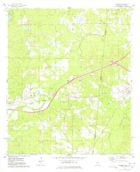
1974 Map of Kewanee
USGS Topo · Published 1978About this map
The Mississippi-Alabama border country in the mid-1970s reveals a rural landscape defined by deep-seated community centers and extractive industry. In Lauderdale and Sumter counties, the settlement of Kewanee serves as a central hub near the intersection of the Southern railroad and modern highways, while Cuba sits just across the state line. The map highlights numerous local landmarks essential for genealogical research, including Sweet Pilgrim Ch, Morning Star Ch, and the Bethel Cemetery.
Find a feature on this map
31 named features on this map. Tap any name to fly to it.
Don’t see what you’re looking for? This feature index may not catch every label — zoom into the map to look around manually.
Map Details
Editions of this 1974 Kewanee Map
This is the sole edition of this map. No revisions or reprints were ever made.
Other maps of this area

1921 · Meridian
USGS Topo · 1:48,000

1923 · Meridian
USGS Topo · 1:62,500

1953 · Meridian
USGS Topo · 1:250,000

1957 · Meridian
USGS Topo · 1:250,000

1962 · Lauderdale
USGS Topo · 1:24,000

1965 · Meridian
USGS Topo · 1:250,000

1971 · Vimville
USGS Topo · 1:24,000
1971 · Toomsuba
USGS Topo · 1:24,000

1974 · Boyd
USGS Topo · 1:24,000

1974 · Ward
USGS Topo · 1:24,000