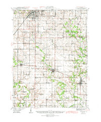
1944 Map of Kewanee
USGS Topo · Published 1944About this map
The industrial and rail hub of Kewanee anchors the northern reaches of this mid-century survey, where the Chicago Burlington and Quincy railroad cuts through the urban grid. Moving south into the rural townships of Wethersfield, Goshen, and Toulon, the landscape reveals a dense network of country schoolhouses that served the agricultural community before widespread school consolidation. Distinctive local names like Bumble Bee Sch, Vinegar Hill Sch, and Snareville Sch dot the townships, often positioned near family burial grounds such as Sheets Cem and Cavanagh Cem. The drainage of the Spoon River and Walnut Creek dictates the movement of the Chicago Rock Island and Pacific line, which connects the smaller settlements of Wyoming and Lafayette to the broader regional economy during the World War II era.
Find a feature on this map
68 named features on this map. Tap any name to fly to it.
Don’t see what you’re looking for? This feature index may not catch every label — zoom into the map to look around manually.
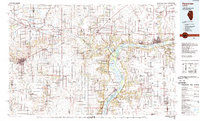
Map Details
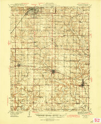
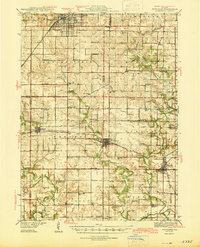
Editions of this 1944 Kewanee Map
3 editions found