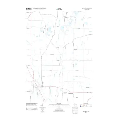
2013 Map of Kewaskum
USGS Topo · Published 2013About this map
The Milwaukee River and its eastern branch carve through this glacial landscape, defining a region rich with kettle lakes and wetlands. The village of Kewaskum serves as a southern anchor, while smaller settlements like New Fane, New Prospect, and Saint Michaels are scattered across the terrain, linked by a network of county highways. This area is characterized by its high concentration of named water bodies, including Mauthe Lake, Auburn Lake, and Forest Lake, which suggest a long-standing history of water-based recreation and conservation.
Find a feature on this map
89 named features on this map. Tap any name to fly to it.
Don’t see what you’re looking for? This feature index may not catch every label — zoom into the map to look around manually.
Map Details
Editions of this 2013 Kewaskum Map
This is the sole edition of this map. No revisions or reprints were ever made.
Other maps of this area

1904 · West Bend
USGS Topo · 1:62,500

1904 · Hartford
USGS Topo · 1:62,500

1955 · Campbellsport
USGS Topo · 1:62,500

1955 · Kewaskum
USGS Topo · 1:62,500

1957 · Madison
USGS Topo · 1:250,000

1959 · West Bend
USGS Topo · 1:62,500

1959 · Hartford
USGS Topo · 1:62,500

1959 · Allenton
USGS Topo · 1:24,000
1959 · Newburg
USGS Topo · 1:24,000
1959 · West Bend
USGS Topo · 1:24,000