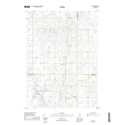
2018 Map of Kewaskum
USGS Topo · Published 2018About this map
Kewaskum serves as the primary hub in this portion of the Kettle Moraine, where the Milwaukee River and its branches carve through the glacial landscape. The village's street grid, including First St, is established near the Holy Trinity church and the Buffalo-Trinity Cemetery. To the north and east, the map reveals a collection of smaller communities and rural landmarks that define the region's historical character, such as New Fane, Saint Michaels, and New Prospect.
Find a feature on this map
106 named features on this map. Tap any name to fly to it.
Don’t see what you’re looking for? This feature index may not catch every label — zoom into the map to look around manually.
Map Details
Editions of this 2018 Kewaskum Map
This is the sole edition of this map. No revisions or reprints were ever made.
Other maps of this area

1904 · West Bend
USGS Topo · 1:62,500

1904 · Hartford
USGS Topo · 1:62,500

1955 · Campbellsport
USGS Topo · 1:62,500

1955 · Kewaskum
USGS Topo · 1:62,500

1957 · Madison
USGS Topo · 1:250,000

1959 · West Bend
USGS Topo · 1:62,500

1959 · Hartford
USGS Topo · 1:62,500

1959 · Allenton
USGS Topo · 1:24,000
1959 · Newburg
USGS Topo · 1:24,000
1959 · West Bend
USGS Topo · 1:24,000