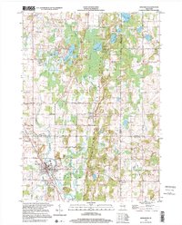
1999 Map of Kewaskum
USGS Topo · Published 2001About this map
Glacial geology and the headwaters of the Milwaukee River define this corner of Wisconsin, where three counties—Fond du Lac, Sheboygan, and Washington—converge. The landscape is dominated by the Kettle Moraine State Forest, a protected corridor of high ridges and kettle-hole lakes like Forest Lake, Mauthe Lake, and Auburn Lake. This geography influenced a fragmented settlement pattern of small hamlets and agricultural pockets rather than large urban centers.
Find a feature on this map
61 named features on this map. Tap any name to fly to it.
Don’t see what you’re looking for? This feature index may not catch every label — zoom into the map to look around manually.
Map Details
Editions of this 1999 Kewaskum Map
This is the sole edition of this map. No revisions or reprints were ever made.
Other maps of this area

1904 · West Bend
USGS Topo · 1:62,500

1904 · Hartford
USGS Topo · 1:62,500

1955 · Campbellsport
USGS Topo · 1:62,500

1955 · Kewaskum
USGS Topo · 1:62,500

1957 · Madison
USGS Topo · 1:250,000

1959 · West Bend
USGS Topo · 1:62,500

1959 · Hartford
USGS Topo · 1:62,500

1959 · Allenton
USGS Topo · 1:24,000
1959 · Newburg
USGS Topo · 1:24,000
1959 · West Bend
USGS Topo · 1:24,000