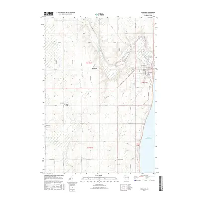
2015 Map of Kewaunee
USGS Topo · Published 2015About this map
Kewaunee sits at the meeting point of the Kewaunee River and Lake Michigan, serving as a focal point for this coastal Wisconsin landscape. The terrain is defined by its proximity to the lake and the winding paths of several water bodies, including Krok Cr, E Twin River, and the marshy Lipsky Swamp to the northwest. These waterways have historically influenced local development, from the settlement at East Krok to the more interior hamlets like Birchwood and Norman.
Find a feature on this map
76 named features on this map. Tap any name to fly to it.
Don’t see what you’re looking for? This feature index may not catch every label — zoom into the map to look around manually.
Map Details
Editions of this 2015 Kewaunee Map
This is the sole edition of this map. No revisions or reprints were ever made.
Other maps of this area

1952 · Casco
USGS Topo · 1:62,500

1954 · Kewaunee
USGS Topo · 1:62,500

1954 · Manitowoc
USGS Topo · 1:250,000

1958 · Manitowoc
USGS Topo · 1:250,000

1960 · Algoma
USGS Topo · 1:62,500

1978 · Casco
USGS Topo · 1:24,000

1978 · Stangelville
USGS Topo · 1:24,000
1978 · Luxemburg
USGS Topo · 1:24,000

1978 · Larrabee
USGS Topo · 1:24,000

1978 · Kewaunee
USGS Topo · 1:24,000