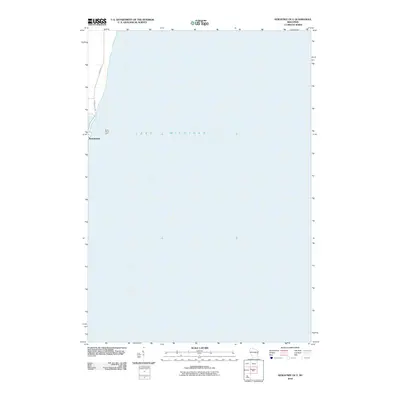
2010 Map of Kewaunee OE E
USGS Topo · Published 2010About this map
Lake Michigan dominates this coastal survey, where the deep waters of the Great Lakes meet the eastern edge of Wisconsin. The lakefront at Kewaunee is a primary point of interest, revealing the maritime orientation of the area. Navigation along the shore is marked by the North Pierce Light, a vital landmark for vessels traversing these waters. On land, the map traces the local transit corridors of Lakeshore Dr and Marquette Dr, which follow the contours of the shoreline. This 2010 edition illustrates the modern interface between the settled community and the vast expanse of the lake, providing a clear record of the coastal geography and nautical infrastructure.
Find a feature on this map
5 named features on this map. Tap any name to fly to it.
Don’t see what you’re looking for? This feature index may not catch every label — zoom into the map to look around manually.
Map Details
Editions of this 2010 Kewaunee OE E Map
This is the sole edition of this map. No revisions or reprints were ever made.
Other maps of this area

1952 · Casco
USGS Topo · 1:62,500

1954 · Kewaunee
USGS Topo · 1:62,500

1954 · Manitowoc
USGS Topo · 1:250,000

1958 · Manitowoc
USGS Topo · 1:250,000

1960 · Algoma
USGS Topo · 1:62,500

1978 · Casco
USGS Topo · 1:24,000

1978 · Kewaunee
USGS Topo · 1:24,000
1978 · Two Creeks
USGS Topo · 1:24,000
1982 · Algoma
USGS Topo · 1:24,000
1984 · Sturgeon Bay
USGS Topo · 1:100,000