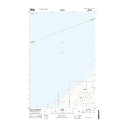
2017 Map of Keweenaw Bay NE
USGS Topo · Published 2017About this map
Abbaye Peninsula extends into the cold waters of Lake Superior in this 2017 survey of Michigan's Upper Peninsula. The map focuses on the northeastern shoreline of Keweenaw Bay, where the boundary between Houghton and Baraga counties cuts through the open water. On land, the interior is characterized by a network of local access roads that service this remote coastal stretch. These routes, including Point Abbaye Rd, Whiskey Rd, and Reeds Point Rd S, provide a detailed look at the modern land divisions and shoreline properties that define the contemporary use of the peninsula. While much of the terrain is dominated by forest and wetland, the inclusion of named lanes like Six Pack Aly and Ravenswood Ct indicates specific areas of recent settlement and development along the water's edge.
Find a feature on this map
14 named features on this map. Tap any name to fly to it.
Don’t see what you’re looking for? This feature index may not catch every label — zoom into the map to look around manually.
Map Details
Editions of this 2017 Keweenaw Bay NE Map
This is the sole edition of this map. No revisions or reprints were ever made.
Other maps of this area

1954 · Traverse Island
USGS Topo · 1:24,000

1954 · Skanee
USGS Topo · 1:62,500

1954 · Keweenaw Bay
USGS Topo · 1:62,500

1954 · Point Mills
USGS Topo · 1:24,000

1958 · Hancock
USGS Topo · 1:250,000

1958 · Iron River
USGS Topo · 1:250,000

1960 · Iron River
USGS Topo · 1:250,000

1960 · Hancock
USGS Topo · 1:250,000

1961 · Iron River
USGS Topo · 1:250,000

1961 · Hancock
USGS Topo · 1:250,000