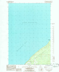
1984 Map of Keweenaw Bay NE
USGS Topo · Published 1986About this map
The Abbaye Peninsula juts into the cold waters of Lake Superior, defining the eastern edge of Keweenaw Bay in this mid-1980s topographic record. The landscape is characterized by the dense timberlands of the Copper Country State Forest, which covers much of the interior terrain. Compiled from 1980 aerial photography, the map captures the rural boundaries of L'Anse and Arvon, showing a coastline largely untouched by heavy development. This provisional edition provides a clear view of the elevation changes along the peninsula's spine, as it slopes toward the shoreline. For researchers of Upper Peninsula geography, it documents the topographical state of this remote shoreline before modern conservation shifts or infrastructure changes altered the access points to the forest and bay.
Find a feature on this map
8 named features on this map. Tap any name to fly to it.
Don’t see what you’re looking for? This feature index may not catch every label — zoom into the map to look around manually.
Map Details
Editions of this 1984 Keweenaw Bay NE Map
This is the sole edition of this map. No revisions or reprints were ever made.
Other maps of this area

1954 · Traverse Island
USGS Topo · 1:24,000

1954 · Skanee
USGS Topo · 1:62,500

1954 · Keweenaw Bay
USGS Topo · 1:62,500

1954 · Point Mills
USGS Topo · 1:24,000

1958 · Hancock
USGS Topo · 1:250,000

1958 · Iron River
USGS Topo · 1:250,000

1960 · Iron River
USGS Topo · 1:250,000

1960 · Hancock
USGS Topo · 1:250,000

1961 · Iron River
USGS Topo · 1:250,000

1961 · Hancock
USGS Topo · 1:250,000