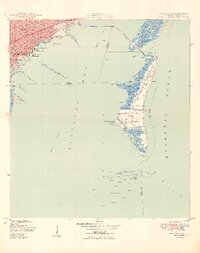
1949 Map of Key Biscayne
USGS Topo · Published 1949About this map
Miami's southern waterfront and the developing barrier islands are captured here just after the Second World War. On the mainland, the Florida East Coast rail line terminates near the urban centers of Silver Bluff and Coconut Grove, while coastal landmarks like the US Coast Guard Air Station and the Fla Adirondack Prep Sch mark the shoreline. The recently completed Rickenbacker Causeway provides a modern link across Biscayne Bay toward Key Biscayne.
Find a feature on this map
42 named features on this map. Tap any name to fly to it.
Don’t see what you’re looking for? This feature index may not catch every label — zoom into the map to look around manually.
Map Details
Editions of this 1949 Key Biscayne Map
2 editions found
Other maps of this area

1947 · Key Biscayne
USGS Topo · 1:24,000

1948 · Soldier Key
USGS Topo · 1:24,000

1949 · Key Biscayne
USGS Topo · 1:24,000

1949 · Perrine
USGS Topo · 1:24,000

1950 · Hialeah
USGS Topo · 1:24,000

1950 · Miami
USGS Topo · 1:24,000

1950 · South Miami
USGS Topo · 1:24,000

1956 · Perrine
USGS Topo · 1:24,000

1956 · South Miami
USGS Topo · 1:24,000
1956 · Soldier Key
USGS Topo · 1:24,000