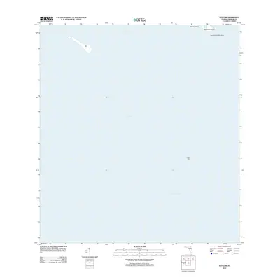
2012 Map of Key Lois
USGS Topo · Published 2012About this map
Key Lois and the surrounding waters of the Florida Keys define this maritime landscape in Monroe County. This survey focuses on the shallow channels and submerged features south of the main island chain, where the Hawk Channel provides a protected passage between the inner keys and the outer reef. To the north, the map identifies Munson Island and Big Munson Island, alongside the scattered Newfound Harbor Keys. Further offshore to the southeast, the isolated landmark of Looe Key sits at the edge of the Straits of Florida, a critical boundary between the turquoise shallows and the open Atlantic. The map is largely a study of bathymetry and small island geography, documenting the precise positions of these keys in the early twenty-first century.
Find a feature on this map
7 named features on this map. Tap any name to fly to it.
Don’t see what you’re looking for? This feature index may not catch every label — zoom into the map to look around manually.
Map Details
Editions of this 2012 Key Lois Map
This is the sole edition of this map. No revisions or reprints were ever made.
Other maps of this area

1921 · Sugar Loaf Key
USGS Topo · 1:62,500

1943 · Saddlebunch Keys
USGS Topo · 1:24,000

1943 · Sugarloaf Key
USGS Topo · 1:24,000

1968 · Saddlebunch Keys
USGS Topo · 1:24,000

1972 · Big Pine Key
USGS Topo · 1:24,000

1972 · Loggerhead Key
USGS Topo · 1:24,000
1972 · Saddlebunch Keys
USGS Topo · 1:24,000

1972 · Summerland Key
USGS Topo · 1:24,000
1972 · Sugarloaf Key
USGS Topo · 1:24,000

1983 · Key West
USGS Topo · 1:100,000