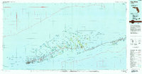
1983 Map of Key West
USGS Topo · Published 1984About this map
Key West serves as the terminal hub for the Overseas Highway in the early 1980s, anchoring an intricate chain of islands and shoals between the Gulf of Mexico and the Straits of Florida. The settlement at Marathon and the engineering feat of the Sevenmile Bridge illustrate the region's total reliance on this singular transit corridor. Beyond the residential clusters, the landscape is defined by federal conservation and military installations, including the Key West National Wildlife Refuge, the Cudjoe Key Air Force Sta, and extensive U.S. Naval Res lands.
Find a feature on this map
149 named features on this map. Tap any name to fly to it.
Don’t see what you’re looking for? This feature index may not catch every label — zoom into the map to look around manually.
Map Details
Editions of this 1983 Key West Map
2 editions found

Other maps of this area

1921 · Sugar Loaf Key
USGS Topo · 1:62,500

1921 · Key West
USGS Topo · 1:62,500

1943 · Bay Keys
USGS Topo · 1:24,000

1943 · Saddlebunch Keys
USGS Topo · 1:24,000

1943 · Boca Chica
USGS Topo · 1:24,000

1943 · Key West
USGS Topo · 1:24,000

1943 · Snipe Keys
USGS Topo · 1:24,000

1943 · Sugarloaf Key
USGS Topo · 1:24,000

1943 · Cottrell Key
USGS Topo · 1:24,000

1956 · Miami
USGS Topo · 1:250,000