
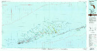
1983 Map of Key West
USGS Topo · Published 1984About this map
Key West serves as the focal point of this Lower Keys survey, showing the city's development alongside the U S Naval Air Station and Key West International Airport. The geography of the archipelago is defined by the thin thread of US Highway 1 (Overseas Highway), which connects the islands across the massive Sevenmile Bridge. The map details the intricate network of channels and basins, such as Cudjoe Basin and Coupon Bight, that separate the various keys and mangrove islands.
Find a feature on this map
119 named features on this map. Tap any name to fly to it.
Don’t see what you’re looking for? This feature index may not catch every label — zoom into the map to look around manually.
Map Details
Editions of this 1983 Key West Map
2 editions found
Other maps of this area

1921 · Sugar Loaf Key
USGS Topo · 1:62,500

1921 · Key West
USGS Topo · 1:62,500

1943 · Bay Keys
USGS Topo · 1:24,000

1943 · Saddlebunch Keys
USGS Topo · 1:24,000

1943 · Boca Chica
USGS Topo · 1:24,000

1943 · Key West
USGS Topo · 1:24,000

1943 · Snipe Keys
USGS Topo · 1:24,000

1943 · Sugarloaf Key
USGS Topo · 1:24,000

1943 · Cottrell Key
USGS Topo · 1:24,000

1956 · Miami
USGS Topo · 1:250,000